 Medieval Turku, Finland - the lost city
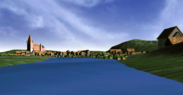 A vivid commercial network was established in the Baltic Sea area during the Middle Ages, mostly through the influence of German merchants of the Hanseatic League. Well-organized towns were established on the southern coast of the Baltic already in the 12th century, and from the beginning of the 13th century, also in Sweden, Finland and the Baltic states. Typical for these towns was that the majority of the leading merchants were German and that the towns were equipped with handsome churches, town halls and stone buildings. The only significant Middle Age town in Finland - Turku - was one of these regional centers, through which furs and miscellaneous products of the northern forests were hauled to Europe (render showing of the river town at the left; hover over to enlarge).
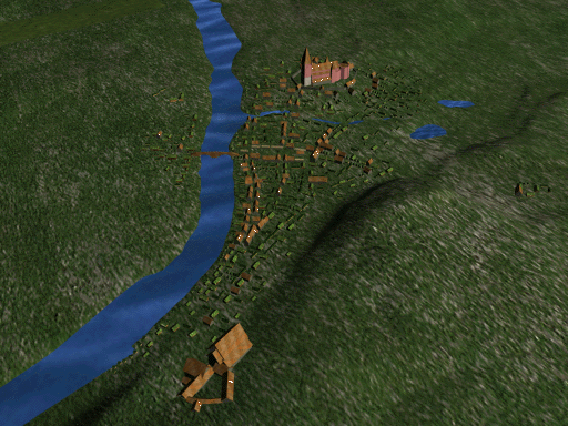 The Medieval city plan of Turku was preserved until the beginning of the 19th century, when a disastrous city fire destroyed the entire city to the ground. What remained was leveled under a 2-3m-thick layer of fill, and the new, Empire-style city was built on top of the old. Research of the old, lost city has been conducted by archaeologists and historians during various excavations for more than a century. In the beginning of the 1990s, a large excavation was started in the very core of the Middle Age town, where the museum "Aboa Vetus" presently resides. Several Medieval streets, city blocks, and buildings were discovered during these excavations, and the idea of creating a reconstruction of the Medieval city of Turku was born (aerial rendering from the 3D model; hover over to enlarge).
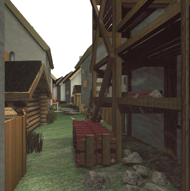
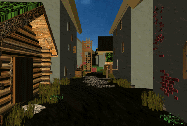 All the discovered buildings and streets were documented digitally, and previously recorded archaeological material regarding various sites in Medieval Turku was added to this data. The resulting CAD model was complemented by adding maps of the city from the 17th and 18th centuries, and eventually a digital model of the entire old Turku was created. The 3D model was further complemented with data regarding levels of original or Medieval surfaces, including changes thereof and exemplified by the small lake in the middle of the city, which disappeared during the early history of this location. All known stone buildings, streets, alleys, bridges, and public buildings (such as the church and town hall) along with known real estate data was added to the true surface model.
 All available archaeological and historical data have been used in the 3D reconstruction of the Medieval city of Turku. Historically recorded differences in the social status and its influence on the buildings of various parts of the town were noted. The initial goal was to construct a model of the town at the end of the 15th century, of a clearly distinct period, which would enable the use of historical data regarding city fires and other events. The exact time frame placed demands on the model in terms of the layering of the constructional history of the town; some buildings were old and tattered, some were usable, while others were new and in a good condition.
Another viewpoint was the botanical environment model provided by the results of research by the natural sciences. The results indicated, that the forests surrounding the town were cut during the Middle Ages, and that the present forests and parks are a result of the active development of the 19th and 20th centuries.
The software used in the project comprises various versions of AutoCadTM (presently Release 14), which was used to create the basic model, which was then transformed into the 3D Studio MaxTM environment (presently Release 2). The 3D Studio MaxTM software was utilized to create different animated sequences of the town, which present both airborne and street-level views. In 1998, a VRML model was added, created by using Max technology and run with the CosmoTM Player software.
The Lost City virtual presentation was opened at the Aboa Vetus museum in April, 1998, and it will be updated during the following years. A broad database is linked to the presentation, which will inform the visitors of the Middle Ages and the research regarding it.
The project creators can be reached at kari.uotila@kolumbus.fi or minna.sartes@utu.fi