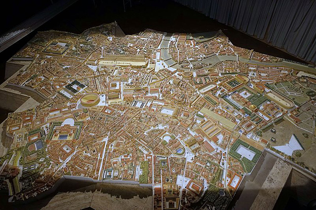
 The ancient city of Rome (recreated in a wooden model in Belgium; see an image at the left; hover over to enlarge), at its height, encompassed roughly 16 square miles (c.41 square kilometers or over 4000 hectares) and most likely held over a million people. The city included palaces, baths, houses, markets, fora, temples, arenas, stadia, and miles of aqueducts and paved streets.
Ancient Rome sprawls across the hills and valleys of the undulating Campagna plain. The city is cut through by the Tiber River, providing Rome with access westward to the Mediterranean Sea. The history of the city and its architecture is well chronicled in too numerous volumes and Websites and need not be repeated here. Our Webpages here, instead, contain the results of Learning Sites' digital reconstructions of particular structures from across the ancient metropolis (as indicated in the pull-down menus above). Enjoy your stay with us.
Carandini, Andrea
2017 The Atlas of Ancient Rome: biography and portraits of the city. Princeton: Princeton University Press (updated and reprinted by Cambridge University Press in 2015).
MacDonald, William Lloyd
1982 The Architecture of the Roman Empire. New Haven: Yale University Press. 2 vols.
Platner, Samuel Ball
1911 The Topography and Monuments of Ancient Rome. Boston: Allyn and Bacon.