Paper presented on April 7, 2000, by Donald H. Sanders, PhD, president of Learning Sites at the annual meetings of the Society for American Archaeology, Philadelphia, Pennsylvania, USA.
posted here October 1, 2019
An important step in the transition from codex-based archaeology to digital archaeology is the use of visualization and presentation techniques that take advantage of what cannot be done on paper. Digital archaeology need not depend upon the visualization tools, linear format, or 2-dimensional display methods of past archaeological reporting. Java, virtual reality, and computer animations can all be seamlessly integrated into the basic methods of disseminating archaeological data.
I'll review some of the drawbacks of traditional publishing methods, counter with new media alternatives, touch on some complications of new media technologies, and conclude with some innovations that may define digital archaeology of this emerging millennium. My focus will be how we can use multimedia technologies for the visualization and distribution of archaeological material via excavation reports, teaching materials, and scholarly reference works. I'll discuss these three different types of publications using three virtual reality-based projects developed by Learning Sites.
Learning Sites designs and develops educational and research software using interactive three-dimensional digital models that are based on actual archaeological evidence and that are reconstructed to the highest standards of scholarship. We integrate archaeological data with advanced computer graphics to further education, data analysis, and the preservation of cultural heritage information. Learning Sites aims to create a globally integrated and interactive network of linked virtual worlds for teaching, research, archaeological fieldwork, museum exhibitions, and on-site interpretation centers.
Multimedia has been around for decades, but is a relatively new means for visualizing archaeological data, for coordinating archaeological publications, and for distributing our interpretive results to colleagues, students, and the general public. For example, take true virtual reality--the term often brings to mind images of exploring imaginary places, spectacular arcade games, weird body suits, motion platforms, and funny goggles. However, nearly 70 projects around the world actively model ancient sites for viewing in virtual reality, or VR.
But what happens when a new technology is introduced into a well-established profession? When the architect, Imhotep introduced ashlar masonry (for the pyramid complex of King Djoser, at Saqqara, around 2800 BC), he designed stone imitations of reeds and other plants, the traditional Egyptian building materials. His innovation relied upon visual forms rooted, so to speak, in the plant-based construction of his predecessors.
And, when Formica was introduced in the 1930s, what designs were first applied to its surfaces? Imitation wood color and wood graining patterns. And where was it first used? On furniture, countertops, and car detailing; that is, its location and visual vocabulary imitated wood--the previous technology. As with Imhotep's use of plant motifs, there is no inherent reason why this should be so, since both cut stone and Formica have qualities suitable for many applications and patterns totally unique to themselves. In each case, it took years before alternative uses and motifs were explored.
Both technological visions became cloaked in the visual vocabulary of the previous technology. This is not to criticize; it just happens. Likewise, many interactive graphics created by archaeologists today often present data in ways that reproduce the look, the presentation mode, and even the graphic style of our predecessor's visualization techniques. Once archaeologists recognize this, we'll have more freedom to apply the new multimedia techniques in ways that aren't just digital replacements for traditional codex-based image types.
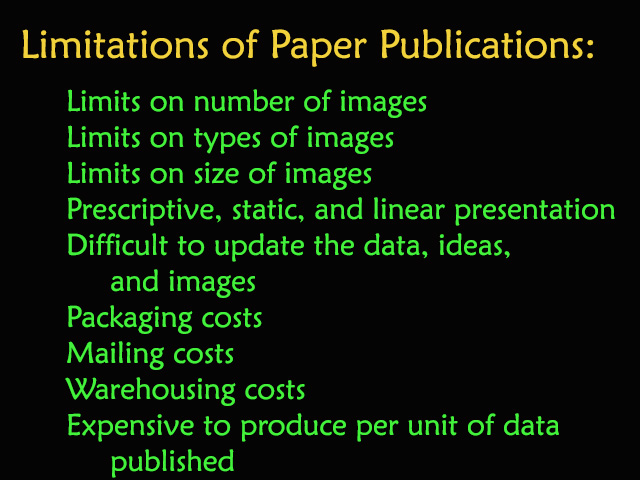
Our dependence on the codex and static 2D images have been basic to our field since our profession's inception. You've all read excavation reports, maybe even bought a few. They typically contain long descriptions of the excavation and its finds, a few charts, and only as many pictures--usually only black and white--as printing costs or book length permits. Illustrations usually include pottery profiles, isolated views of a few artifacts or trenches, and token line drawings of key features. Architectural drawings unquestionably repeat the plans, sections, and elevation reconstructions used since our discipline's 18th-century origins. But is a publication with long descriptions, a few greyscale illustrations, and a couple of line drawings and graphs really sufficient for truly understanding a site in its stratigraphic or cultural complexity? I think not. Even the most comprehensive reports necessarily present only selected portions of the whole story; only single static views of artifacts, buildings, trenches, and history.
And what about updates? How are ideas in paper publications expanded when new information becomes available, new interpretations offered, and new visualizations created? Not easily. Articles are published and conference papers delivered, but the original publication remains a static document. Synthesizing the very latest material with previously published information is a continuing chore.
Today's emphasis on quantitative methods of interpretation and on explanations of cultural totality demand more information. But not just more data without interpretation, not just more without innovative methods of assimilating and displaying the extra material. Just access to more stuff won't work; just look at the 'Net. Utilizing the new multimedia technologies can eliminate many difficulties with traditional archaeological publications.
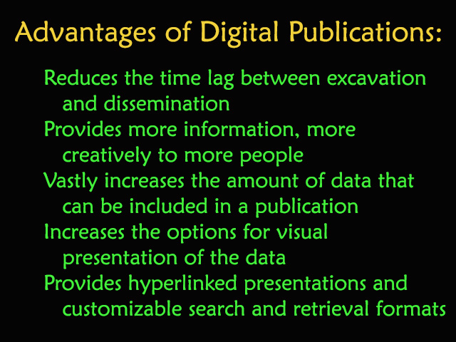
We can overcome these limitations, creating greatly enhanced digital products and offering them to a wider audience, more quickly, more efficiently, and more cost-effectively than ever before.
I'll discuss the benefits of alternative new media archaeological publications, of breaking free of traditional plans and sections (of the wood-grained or papyrus-shaped veneer). These three Learning Sites digital publications illustrate some of our attempts to redefine the encyclopedic research resource, the excavation report, and the visual aid for teaching.
1 - The massive research resource:
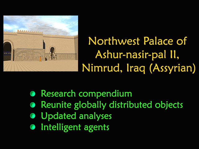
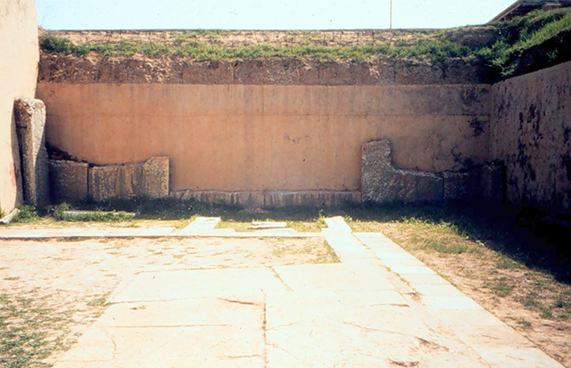
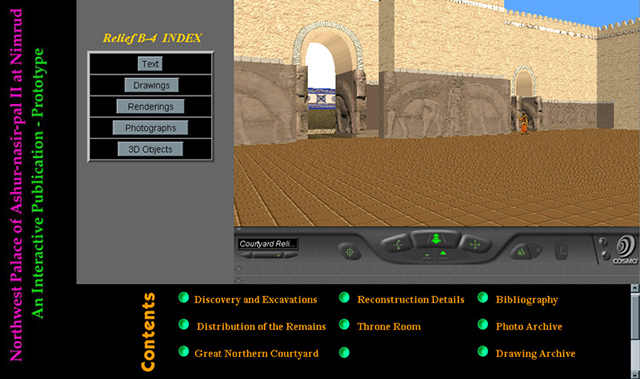
The immense Assyrian Palace of Ashur-nasir-pal II (9th century BC), at Nimrud (in northwest Iraq), was excavated by Austen Henry Layard in the 1840s. Since then relief decoration has been systematically removed from its context, chopped up, and shipped to major museums and private collections around the world (see a view of the throne room at the left, missing the wall reliefs that had been cut away from the walls; photo courtesy of Samuel Paley; hover over to enlarge). The material is becoming even more globally distributed through secondary selling and looting, which continues today. This is a tremendous loss for scholars; the original sculptural program and ritual inscriptions can no longer be viewed or studied in their complex entirety. Anyone visiting the site or seeing pieces of relief in museums can no longer appreciate the grandeur and scale of the monument (ed. note 9/2019: since this lecture, the Northwest Palace has been dynamited by ISIS/Daesh and no longer exists; Learning Sites virtual reality reconstruction is all scholars have now to view and study the monument).
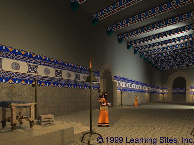
It's a scenario begging for VR. Learning Sites, with archaeologists and architects in America and Poland, are digitally re-building the palace and re-locating visual surrogates of the reliefs, based on surviving evidence from collections all over the world and from reconstruction drawings (see the Learning Sites digital reconstruction of the throne room from the Northwest Palace at the left; hover over to enlarge).
New media techniques allow us to collocate vastly more amounts of visual data, analyses, and background information, than any paper format would allow, and in ways unthinkable just a few years ago. The result will be a virtual re-creation of the architectural design and sculptural program of the entire Palace as a massive research and educational tool issued partly on DVD and partly on the Internet. Users will be able to explore the building independently or interact with intelligent agents, virtual Assyrians programmed to act as site interpreters.
2 - The excavation report:
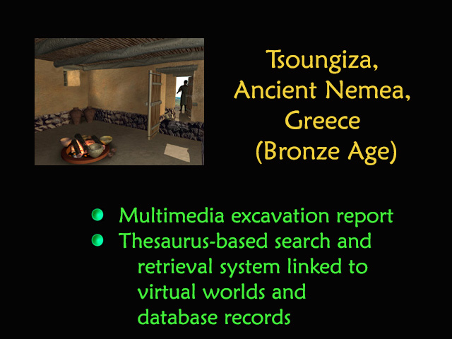
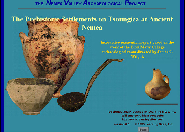
The Bronze Age settlement of Tsoungiza, Ancient Nemea, Greece, was excavated during the 1980s, under the direction of a team from Bryn Mawr College. Our final publication will include all information retrieved during excavation, all the artifacts, architecture, field notebook pages, database records, photographs, drawings, and analyses (see a screen grab of the homepage of the online publication at the left; hover over to enlarge).
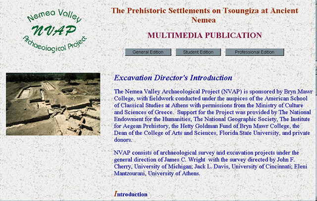
The entire report will be interactive, and present the data in 3 levels of depth, for the general public, for students, and for professionals (see a screen grab of the introduction page at the left; hover over to enlarge). The result will be published on DVD and the Internet, allowing links to background information, future updates, and new analyses. To take advantage of new multimedia possibilities, we developed a few features that have been beneficial to the archaeologists for their interim studies, teaching, and fundraising. For example, we enhanced the trench plan by overlaying it with excavation photos to provide a check on the accuracy of the drawings, to depict settlement development more easily than possible with traditional site plans, and to use the views as hooks to access their photo archive.
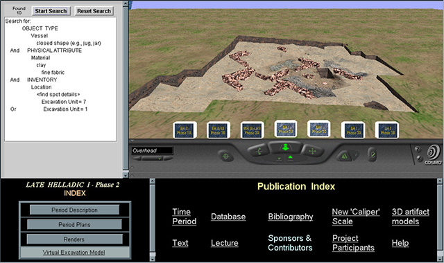
To make this publication a truly nonlinear, personalized, and customizable research tool (fig. 12 - live demo?), we have designed a Java-driven searchable database that links artifact records to virtual artifacts accurately located in their virtual contexts, and vice versa. Objects in the virtual worlds will be linked back to their database records, photographs, drawings, and analyses. The virtual worlds thus become visual indexes to all the data about Tsoungiza. This all-digital, virtual reality-based excavation report, will also feature recorded lectures and video tours by the excavators, and computer flyovers of the site at re-creations of different stages in its history (see the screen grab at the left; showing the searchable database, the virtual as-excavated world with buttons to activate different period models, the local index, and the full publication index; hover over to enlarge).
3 - The educational package:
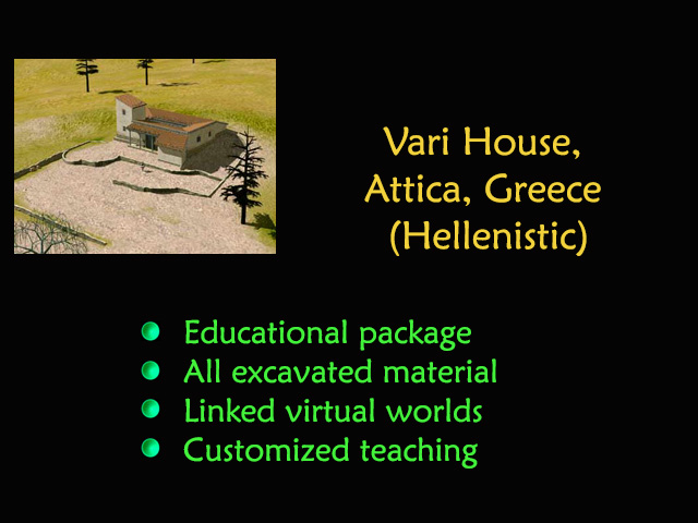
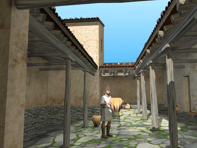
The Hellenistic farmhouse at Vari, about 18km southeast of Athens, was excavated by the British School in 1966 (see our 3D reconstruction of the Vari House courtyard at the left; hover over to enlarge). This small isolated building was home to a family of beekeepers, proving that ancient writers' claims were accurate when they wrote that the best honey came from the slopes of Mt. Hymettus in Greece, precisely where the Vari house is located. As a single period thoroughly excavated site, the farmhouse offers a unique glimpse into rural life around 300 BC.
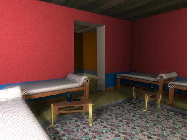
The House of Many Colors at Olynthus, northern Greece, also a single period site, was destroyed by Philip of Macedon in 348 BC. Many artifacts were recovered during the excavation of this house and it is preserved to a great extent (see our 3D reconstruction of the andron from the House of Many Colors at the left; hover over to enlarge). The two domestic sites together make an ideal backdrop for a public-school educational package providing real-life content for teaching about ancient Greek history, town planning, and religion, as well as excavation methods and ancient construction techniques.
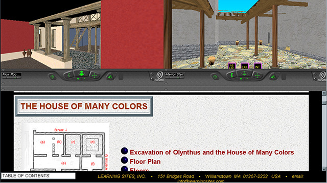
Using the entire Vari excavation archive and recent re-analyses of Olynthus, we produced an educational package to meet curriculum guidelines proposed by the National Council on Social Studies for teaching ancient history, trade, government, and geography. We also incorporated the guidelines set by the Virtual Reality in Education Laboratory at East Carolina University in North Carolina for using VR in the classroom. Our final package enlivens the comparison between life in an ancient farmhouse with life in an ancient townhouse through the use of linked virtual worlds, computer flyovers, sounds, animated characters, interactive artifacts, and links among excavation drawings and photographs, field notebook pages, and descriptive text (see a sample screen grab from the package at the left, showing the two virtual worlds on top and the linked text below; hover over to enlarge). The result provides an engaging, participatory, multimedia learning experience that gives teachers real historical situations as the basis for education. This is the site report as teaching aid.
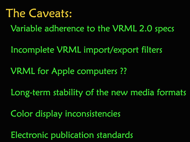
These are not final solutions nor have all the problems with multimedia-based archaeological publications been resolved (see the summary of caveats at the left; hover over to enlarge). For example:
So, despite some caution--regarding mainly technical, not intellectual, obstacles--the advantages of digital multimedia and virtual-reality-based publications are many. They include: interactive self-guided research or teaching, access to the full range of excavated material, ability to virtually hold and investigate closely each artifact, and availability of data to a wider audience more quickly, more efficiently, and more cost effectively.
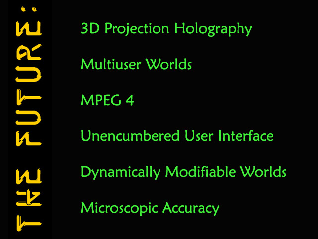
Much innovation is still to come. 3D scanners will replicate the ancient world with millimeter accuracy and in conjunction with the projection holographs will be able to simulate intricate, full-scale, realtime spatial experiences. Multiuser virtual worlds will permit several scholars to visit and study computer-generated ancient sites together. MPEG 4 will allow multimedia presentations to take place within virtual worlds permitting real-time distance education and video-conferencing. User interfaces won't depend on datagloves, spaceballs, or mice; instead body movements will be tracked in 3D space and translated into virtual world coordinates. Voice recognition systems will enhance input and conversations with intelligent agents to make searching vast databases more efficient. 3D semantic networks will facilitate the translation between user queries and databases. More spectacular will be the ability to modify virtual worlds while moving through them in real time to test hypotheses about the archaeological record against virtual simulations of the real events.
And so, this is a very exciting time for us. Remember, our study of the past need not rely on methods of the past. New media technologies can be brought to bear on all aspects of data recovery, analysis, and publication, and our questions about the past can only benefit from these new means of visualizing the answers.